

even google maps doesn’t believe somaliland anymore
The digital map now mirrors the political reality, somaliland’s borders are cracking on the ground and on the screen.

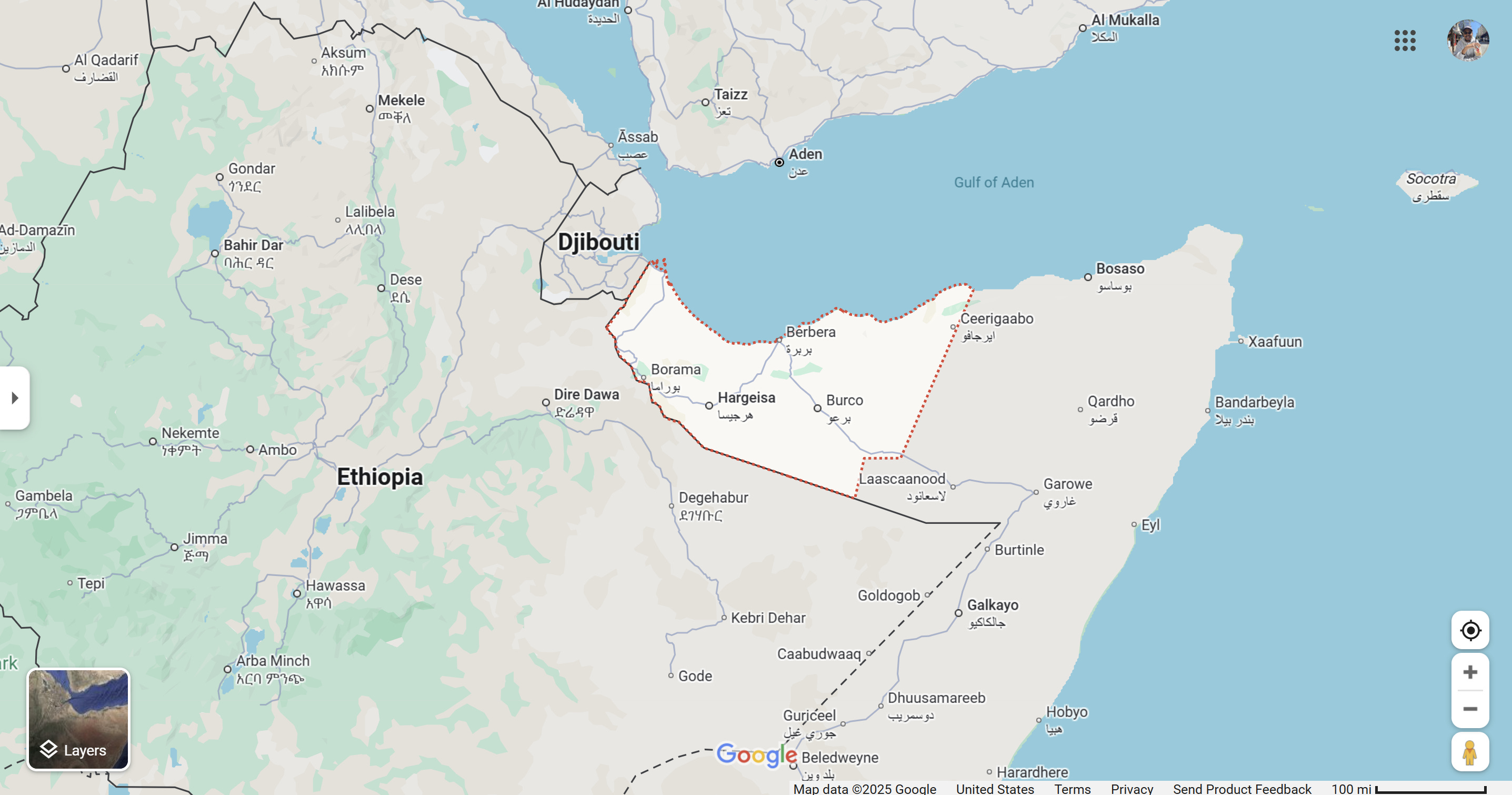
Looks like Google Maps has dealt Somaliland another blow, its outline just got smaller, with the Northeastern state split off. For a territory that’s built its whole case on “democracy”, “stable borders” and “effective control,” seeing the map shrink is symbolic. It’s the digital version of what already happened on the ground in Laascaanood: Somaliland’s exceptionalism story is cracking, and now even the maps are catching up.
And it matters that it’s Google doing this because for most of the world, Google Maps is the default reality. Policymakers, journalists, investors, and the public all treat what they see there as fact. So when Somaliland shrinks on that screen, it shows the world that the story Hargeisa has been selling for decades is breaking down.
Read these two articles for context:
Firdhiye & the Northeastern State: I break down how Firdhiye’s election turned SSC-Khaatumo into a full federal state of Somalia and why that’s a direct hit to Somaliland’s independence claim.
firdhiye’s election and the collapse of somaliland’s independence narrative
·
For decades, Somaliland has presented itself as the exception in the Horn of Africa, a territory that broke away from Somalia in 1991 and built the facade of a stable, functioning democratic state wh…
Somaliland’s Recognition Push: I dig into the UAE–Israel–U.S. angle, showing how Somaliland is trading Berbera and its sovereignty for a shot at recognition.
the somaliland recognition roadshow
·
Over the past year, a quiet but coordinated marketing push has been trying to sell a new Israel–Somaliland recognition framework, essentially an extension of the Abraham Accords model, this time in t…

